
Connectivity across habitats and animal populations is critical to conservation. Connectivity is forged by animal movements – or dispersal – across large heterogeneous landscapes. Connectivity boosts the ability of animals to persist over time, and enhances both immunity and adaptability of animal populations, and helps prevent local extinctions. When local extinctions do occur, connectivity allows animals to recolonise previously occupied but currently empty or depauperate habitats.
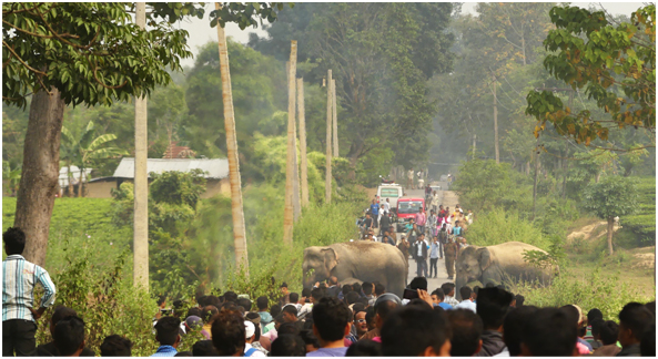
Today, habitats are sometimes severely fragmented, and human presence has drastically restricted animal movement. This limits their ability to traverse fragmented landscapes. Even well-intentioned measures sometimes block connectivity. For example, the large-scale erection of fences around protected areas as a purported solution for reducing human–wildlife conflict blocks connectivity, and can isolate populations. There is thus, much to be learnt and done to ensure that linkages across animal populations continue to be maintained.
All of the above holds especially true for the Asian elephant (Elephas maximus), India’s National Heritage Animal and an endangered species that is present across 13 countries in Asia. Elephants range widely, sometimes over 100s of kilometres, to meet their immense food and water requirements. To put this in context, the average size of protected areas in India is <300 km2, close to the average home range size of a single elephant herd. In recognition of this need to expand conservation efforts outside protected areas, government policy has rightly identified the ‘landscape’ as a unit of conservation for elephants. Thus, Elephant Reserves, by design, are meant to incorporate protected source habitats, corridors, and multiple-use areas. But practice is slow to follow policy; elephant corridors are not well identified, factors that facilitate or impede elephant movement within and across Elephant Reserves are yet to be well studied, and conservation practice and actions on-ground are not geared towards landscape-scale conservation of elephants.
Our research, published in Diversity and Distributions, addresses these issues squarely. We have used data on elephant presence across heterogeneous areas to identify locations most suited to elephant dispersal, as well as factors that facilitate or impede such movement.
We collected empirical data on elephant use of lands outside protected areas—paddy fields, plantations, human habitations, and forestland—across 7,500 km2. We used these data in newly developed movement models to identify areas most critical to connectivity across a 20,000 km2 region of Northeast India. This work is significant for a few reasons. One, dispersal and connectivity, occurring infrequently and across large landscapes, has traditionally been a difficult subject of study. Collecting data relevant to animal use of landscapes has been difficult, especially because events of animal movement in certain important corridor areas may happen just a few times a year. We took advantage of the fact that elephants are visible, noticed by people, and are unambiguously recognisable, to systematically collect citizen-reports of elephant use of a multitude of areas. We questioned >1000 farmers across this region, recording each time a respondent reported elephant presence in their immediate neighbourhood. In total we used >200 reports of elephant presence in multiple-use lands to model connectivity.
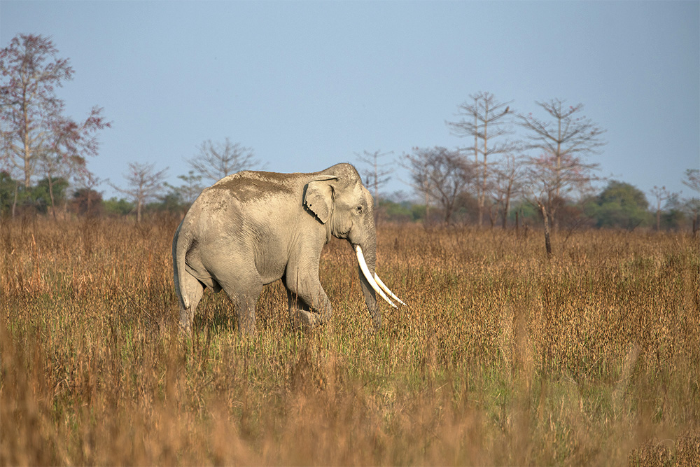
Simultaneously, we recorded factors that may impede or facilitate elephant movement. We used the Google Earth Engine and satellite imagery to classify the entire region into different land cover types. We used existing information on human population density, and calculated distance to forest and vegetation cover. We found that elephants used areas with high vegetation cover for movement. Despite being animals that can traverse great distances, they did not venture far from forests, highlighting the role of forests as refuges for these and other species. They avoided areas with a high human population density, likely associating risk with human presence and potential conflict.
Elephants use areas of high vegetation cover and low human presence, that are close to forests for dispersal. Photo credit: Bhavendu Joshi/Conservation Initiatives
We incorporated this understanding into newly developed connectivity models, called Randomised Shortest Path (RSP) models. To our knowledge, this is the first application of RSP models—a very new advancement in the field of wildlife connectivity—in India.
This is also likely the first time globally that citizen science data, which are relatively more feasible to collect, have been used with RSP or other advanced connectivity models. A recognised issue of such models is the need for them to be informed by empirical data relevant to animal movement and use of the landscape. While our data does not track elephant movement per se—like radio telemetry does—it does offer pertinent insight on elephant use of lands outside protected areas. Such a combination opens opportunities for applying advanced connectivity models for species or landscapes otherwise limited by lack of appropriate data.
The results of our model are two-fold. One, it answers the question, where should elephant connectivity conservation (e.g., securing corridors, protecting existing forests, removing blockades and fences, incentivising safe elephant passage through private lands) be focused, via fine-scale 1-km2 maps. Second, it addresses the issue of why elephants move through some areas and not others, and thus provides an indication to how we can strategically target connectivity conservation action. For instance, our work adds to previous findings from scientific studies, including our own work, that vegetation and wooded areas even on private lands, can facilitate critical animal movement. Government policies that encourage woody vegetation on private lands, incentivise preservation of wooded areas on private lands, and strictly limit deforestation in important connectivity areas, are clearly indicated.
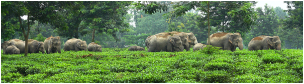
Elephants survive in fragmented landscapes, and maintaining connectivity is increasingly critical for their conservation. Photo credit: Conservation Initiatives
The relevance of connectivity extends well beyond the preservation of single species. Corridors for elephants may serve as important movement zones for other less studied species as well. Connectivity conservation occurs at the human–wildlife interface and guides us to look for conservation approaches that facilitate shared human–wildlife spaces and their coexistence. Connectivity is also recognised as a key mitigation tool for climate change. For all these reasons and more, connectivity conservation assumes prime importance, and science that guides and backs connectivity conservation policy and on-ground action is urgently needed. With our work, we seek to fill this knowledge gap, and thus improve our practice of connectivity conservation.
The paper referred to in this article, titled ‘Identifying important connectivity areas for the wide‐ranging Asian elephant across conservation landscapes of Northeast India’, is published in the peer-reviewed scientific journal Diversity and Distributions, and can be accessed here:http://doi.org/10.1111/ddi.13419.