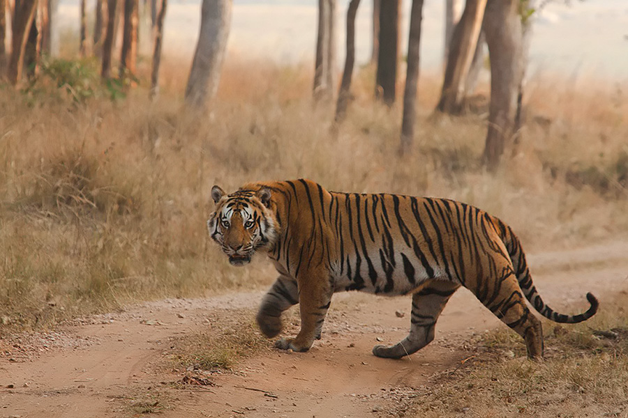
It turns out that – when it comes to protecting India’s tigers – size matters, just not in the way most people might think. Large protected areas are clearly important for such a wide-ranging, territorial species. But in what may be a somewhat counter-intuitive finding, new research also shows that small protected areas often play a disproportionate role in ensuring the long-term survival of tigers in Central India.
Over the last several years, India has been working to improve tiger conservation by declaring as many protected Tiger Reserves as possible — with around five being declared in 2015 alone. A Tiger Reserve is a category of Protected Area that is especially designated for tiger conservation, and has administrative and funding mechanisms that are different from other categories of PAs.
However, because landscapes outside the reserves are changing so drastically, just protecting isolated islands of habitat surrounded by an ocean of development will not be enough to protect the big cats into the future. Mainly because tigers don’t stay inside Tiger Reserve boundaries.
Our paper Connecting the Dots: Mapping Habitat Connectivity for Tigers in Central India,(1) in Regional Environmental Change identifies areas in the landscape that are important to tiger movement.
To help determine which parts of the landscape provide connectivity between designated reserves in a large region of Central India (approx. 373,704 sq.km), we examined three data layers:
- Landcover and land use
- Transportation networks (roads and railways), and
- Human population density
We used a combination of least-cost corridors (methods that identify which parts of the landscape provide least resistance to tiger movement) and circuit theory.

Map of study landscape. The location in India is shown in the inset. State and district boundaries are shown black and gray, respectively. Protected areas are shown in green, and big cities/towns (with population greater than 88,000 people) are represented as red dots.
We found that although this part of India has been heavily modified by human activity (more than half of the total area we studied is cultivated), there are still opportunities to maintain connectivity between the different reserves.
We used centrality methods to map which reserves and linkages had the most potential of being used most frequently. This approach provides a way to quantify which areas are absolutely integral to maintaining animal movement.
We found Kanha and Pench Tiger Reserves, and the linkages from and between them, have high values. This means that these reserves and linkages play an important role in maintaining connectivity in this region. However, other reserves with lower centrality values are likely to be important in maintaining connectivity with reserves outside our delineated region.
This result is really exciting because two previous genetic studies (2, 3) in the landscape have shown the same reserves (Kanha and Pench) to be source populations for tigers.
Small Areas Can Equal Big Returns for Tiger Conservation
Much of the study confirmed what tiger researchers have long suspected – that designated Tiger Reserves and protected areas are foundational to protecting India’s tigers in the wild.
But what has not been shown until now, is that smaller reserves have a much higher contribution and role in maintaining connectivity than one would predict by their size alone. This result shows that small reserves are important conservation investments as they provide important stepping stones to tiger movement.

Pairwise pinch points, shown in shades of yellow, indicate areas where current flow is highly restricted between adjacent pairs of PAs. Railway lines and major roads are also shown. Units are current density (Amps/cell).
We mapped pinch points, which are areas within linkages where movement is restricted, often by the lack of appropriate land cover, or features that are avoided by tigers, such as roads or high human population density. Pinch points represent areas where movement would be funneled and thus may be particularly important to keeping a linkage viable.
Understanding the Pinch Points
Even a small loss of area in these pinch points – highlighted above as the bright yellow sections between Kanha and Pench Tiger Reserves for example, would disproportionately compromise connectivity. This result also shows that a lot of these linkages are narrow and highly constrained. To summarize, we mapped areas that are most likely to be used by tigers when moving outside of protected areas, and demonstrated that even small reserves can be useful when moving through human dominated landscapes such as in central India.
Tiger Reserves are incredibly important as anchors for conserving tigers in India, but as the pressures of development mount outside the reserves, land managers and decision makers will need to consider how tigers use the landscape outside the reserves. These linkages need to be identified and protected in order to preserve natural biological processes such as long-range movements, which are integral for large carnivore conservation.
References:
- Dutta, T., Sharma, S., McRae, B.H., Roy, P.S., & DeFries, R. (2015). Connecting the dots: mapping habitat connectivity for tigers in central India. Regional Environmental Change, doi:10.1007/s10113-015-0877-z
- Sharma, S., Dutta, T., Maldonado, J.E., Wood, T.C., Panwar, H.S., & Seidensticker, J. (2013b). Forest corridors maintain historical gene flow in a tiger metapopulation in the highlands of central India. Proc. R. Soc. B Biol. Sci., 280, 20131506. doi:10.1098/rspb.2013.1506
- Yumnam, B., Jhala, Y.V., Qureshi, Q., Maldonado, J.E., Gopal, R., Saini, S., Srinivas, Y., & Fleischer, R.C. (2014). Prioritizing tiger conservation through landscape genetics and habitat linkages, PLoS ONE, 9, e111207. doi:10.1371/journal.pone.0111207


 CI is a non-profit, non-commercial portal that aims to facilitate wildlife and nature conservation by providing reliable information and the tools needed to campaign effectively.